


Drone Technology in Surveying
- Real-Time Experts Sessions
- LIVE Project
- Certification
- Affordable Fees
- Flexibility
- Placement Support
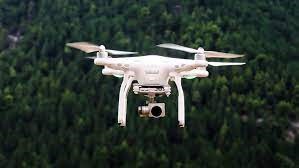
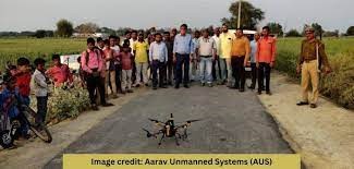
Drone technology, also known as Unmanned Aerial Vehicle (UAV) technology, has revolutionized surveying practices by offering an efficient and cost-effective means of data collection. In surveying, drones are equipped with various sensors and cameras to capture high-resolution imagery and other geospatial data. Here’s an overview of drone technology in surveying
If you are looking to get trained in Drone Technology in Surveying, then you can avail the best Drone Technology in Surveying training in Indore at Tech Cluster, an institute in Indore that covers all the important factors from basic to advanced interview preparation and 100% placement assistance in 3D Studio Max Training.
Applications :
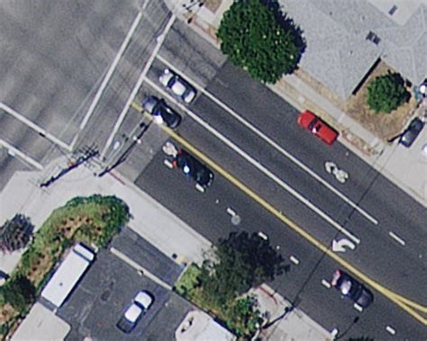
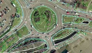
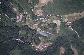
Drone technology revolutionizes surveying with applications ranging from topographic mapping and construction site monitoring to volumetric analysis, environmental monitoring, and precision agriculture. Drones enable efficient utility and infrastructure inspections, contribute to disaster management, aid in archaeological site documentation, and support wildlife monitoring. Their versatility extends to transportation infrastructure planning and real estate assessments, making them invaluable tools for obtaining accurate and timely data across various surveying domains.
Civil
Course Highlights:
Drone Technology in Surveying Foundation :
• Aerial Imaging and Photogrammetry:
• Topographic Surveys:
• Orthomosaic Mapping:
• Survey Grade Accuracy:
• Efficiency and Cost-Effectiveness:
• Construction Site Monitoring:
• Volumetric Analysis:
• Infrastructure Inspection:
• Environmental Monitoring:
• Regulatory Compliance:
• Integration with GIS (Geographic Information Systems):
• Training and Skill Development:
Duration :
- 50 Hours Theory
- 35 Hours Practical
- 45 Hours Project work
Drone Technology in Surveying Foundation :
Aerial Imaging and Photogrammetry:
• Drones equipped with high-resolution cameras capture aerial imagery of a survey area.
• Photogrammetry software processes these images to create detailed 3D models, maps, and point clouds.
Topographic Surveys:
• Drones can quickly and accurately collect topographic data for mapping terrain, identifying elevation changes, and creating contour maps.
• The high-resolution imagery aids in the visualization of the surveyed area.
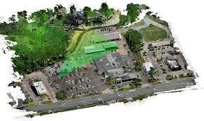
Orthomosaic Mapping:
• Drone-generated orthomosaic maps provide detailed, georeferenced images of large areas, offering a high level of accuracy.
• These maps are valuable for land development, urban planning, and infrastructure projects.
Survey Grade Accuracy:
Some advanced surveying drones are equipped with RTK (Real-Time Kinematic) or PPK (Post-Processing Kinematic) systems, ensuring centimeter-level accuracy in survey data.
Efficiency and Cost-Effectiveness:
• Drones can cover large areas quickly, reducing the time and cost associated with traditional surveying methods.
• They are particularly beneficial for inaccessible or hazardous terrain.

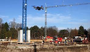
Construction Site Monitoring:
• Drones are used to monitor construction sites, track progress, and ensure that the work aligns with design plans.
• They facilitate real-time decision-making and help prevent and identify potential issues.

Volumetric Analysis:
• Drones can calculate stockpile volumes accurately by capturing images and generating 3D models.
• This is useful in industries like mining and aggregates, where tracking material volumes is essential.

Infrastructure Inspection:
- Five different type of renderer are available
- Supports hardware rendering (Quicksilver hardware renderer)
- Creates physically accurate renderings by tracing light paths. (V-ray renderer)
- Versatile series of scanlines are generated from top to bottom (Default scanline renderer)
- Physically correct simulations of lighting effects, including ray-traced reflections and refractions, caustics, and global illumination are generated (Mental ray renderer)
- Supports for other third-party rendering software
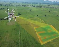
Environmental Monitoring:
Drones can be used for environmental surveys, including monitoring vegetation health, identifying erosion, and assessing the impact of natural events.
Regulatory Compliance:
Surveying with drones must adhere to aviation regulations and local laws. Operators often need to obtain appropriate certifications and permissions from aviation authorities.
Integration with GIS (Geographic Information Systems):
Upcoming Batches
Certifications
3Ds Max Certification Training
About 3Ds Max Certification Training in Indore at Tech Cluster


Reviews